Category:Sampford Brett
Jump to navigation
Jump to search
English: Sampford Brett is a village and civil parish situated at the north-western edge of the Quantock Hills, Somerset, England, less than 1 mile (1.6 km) south of Williton, just off the A358 road to Taunton.
village and civil parish in Somerset, United Kingdom  | |||||
| Upload media | |||||
| Instance of | |||||
|---|---|---|---|---|---|
| Location | Somerset West and Taunton, Somerset, South West England, England | ||||
 | |||||
Subcategories
This category has only the following subcategory.
S
Media in category "Sampford Brett"
The following 92 files are in this category, out of 92 total.
-
 'Royal Tank Regiment' with a train for Minehead - geograph.org.uk - 5803999.jpg 1,024 × 763; 215 KB
-

-
 A red stream, Aller Farm - geograph.org.uk - 1654792.jpg 640 × 430; 154 KB
-
 A wheat-field beside the railway near Williton - geograph.org.uk - 6218293.jpg 1,024 × 768; 521 KB
-
 Aller Farm - geograph.org.uk - 1654705.jpg 640 × 430; 52 KB
-
 Aller Farm - geograph.org.uk - 98810.jpg 640 × 480; 116 KB
-
 Aller Lane - geograph.org.uk - 1654926.jpg 640 × 430; 167 KB
-
 Aller Lane - geograph.org.uk - 1654972.jpg 640 × 430; 159 KB
-
 Aller Lane - geograph.org.uk - 1654979.jpg 640 × 430; 143 KB
-
 Aller Lane - geograph.org.uk - 1654986.jpg 640 × 430; 163 KB
-
 Aller Lane - geograph.org.uk - 1655006.jpg 640 × 430; 117 KB
-
 Aller Lane heading to Williton - geograph.org.uk - 1654991.jpg 640 × 430; 167 KB
-
 Barn by Honey Row Lane - geograph.org.uk - 5992001.jpg 4,143 × 1,924; 802 KB
-
 Barn, Aller Farm - geograph.org.uk - 1654691.jpg 640 × 430; 38 KB
-
 Bicknoller , Lucas's - geograph.org.uk - 6259000.jpg 6,000 × 4,000; 6.3 MB
-
 Bicknoller , Railway - geograph.org.uk - 6258996.jpg 6,000 × 4,000; 7.84 MB
-
 Bicknoller , Taunton Road A358 - geograph.org.uk - 6258997.jpg 6,000 × 4,000; 6.83 MB
-
 Bicknoller , Taunton Road A358 - geograph.org.uk - 6258999.jpg 6,000 × 4,000; 7.08 MB
-
 Bus stop on the A358 - geograph.org.uk - 3406373.jpg 1,024 × 768; 170 KB
-
 Castle Hill - geograph.org.uk - 2990112.jpg 1,024 × 685; 941 KB
-
 Cattle, Sampford Brett - geograph.org.uk - 1947563.jpg 640 × 328; 54 KB
-
 Cattle, Sampford Brett - geograph.org.uk - 1947594.jpg 640 × 371; 79 KB
-
 Channel to Channel (505) - geograph.org.uk - 4470026.jpg 800 × 600; 172 KB
-
 Channel to Channel (506) - geograph.org.uk - 4470030.jpg 800 × 600; 222 KB
-
 Channel to Channel (507) - geograph.org.uk - 4470031.jpg 800 × 600; 116 KB
-
 Channel to Channel (508) - geograph.org.uk - 4470035.jpg 600 × 800; 211 KB
-
 Channel to Channel (509) - geograph.org.uk - 4470046.jpg 800 × 600; 120 KB
-
 Channel to Channel (510) - geograph.org.uk - 4470047.jpg 800 × 600; 175 KB
-
 Church in Sampford Brett - geograph.org.uk - 4863233.jpg 4,000 × 3,000; 2.53 MB
-
 Corner of meadow, Sampford Brett - geograph.org.uk - 1947575.jpg 640 × 417; 84 KB
-
 Crossroads, near Bicknoller - geograph.org.uk - 2315179.jpg 1,024 × 768; 146 KB
-
 Crossroads, Sampford Brett - geograph.org.uk - 3456924.jpg 1,024 × 768; 164 KB
-
 Electricity pylon, near Sampford Brett - geograph.org.uk - 3456961.jpg 768 × 1,024; 131 KB
-
 Farmland by Honey Row Lane - geograph.org.uk - 5992007.jpg 4,163 × 2,353; 1.71 MB
-
 Farmland on the east bank of Doniford Stream - geograph.org.uk - 4094926.jpg 1,024 × 768; 132 KB
-
 Farmland on the south side of Castle Hill - geograph.org.uk - 4094950.jpg 1,024 × 768; 141 KB
-
 Farmland west of Torweston Farm - geograph.org.uk - 4094937.jpg 1,024 × 768; 109 KB
-
 Field margin near Fishwell Copse - geograph.org.uk - 3337323.jpg 1,024 × 768; 233 KB
-
 Field margin near Woodford - geograph.org.uk - 3337337.jpg 1,024 × 768; 176 KB
-
 Field on the edge of Williton - geograph.org.uk - 1655012.jpg 640 × 430; 141 KB
-
 Footbridge on Doniford Stream - geograph.org.uk - 4804082.jpg 1,024 × 768; 273 KB
-
 Footbridge over the Doniford Stream - geograph.org.uk - 4869557.jpg 4,000 × 3,000; 4.74 MB
-
 Footpath through Sampford Mill Farm - geograph.org.uk - 4869578.jpg 3,681 × 2,761; 2.93 MB
-
 Francis Farm - geograph.org.uk - 4804079.jpg 1,024 × 768; 183 KB
-
 Gates to Sampford Brett - geograph.org.uk - 1947654.jpg 640 × 480; 113 KB
-
 Goods train passes Castle Hill - geograph.org.uk - 6291820.jpg 1,024 × 719; 176 KB
-
 Hayfield alongside the A358 - geograph.org.uk - 4094957.jpg 1,024 × 768; 109 KB
-
 Heading to Williton - geograph.org.uk - 1654997.jpg 640 × 430; 144 KB
-
 Hide on southern edge to Black Down Wood - geograph.org.uk - 99268.jpg 480 × 640; 120 KB
-
 Honey Row Lane - geograph.org.uk - 5990822.jpg 4,288 × 2,848; 1.83 MB
-
 Houses on the edge of Williton - geograph.org.uk - 3936908.jpg 640 × 480; 112 KB
-
 Line of a drain in the valley of Doniford Stream - geograph.org.uk - 4094936.jpg 1,024 × 615; 118 KB
-
 Local train heads for Stogumber - geograph.org.uk - 6291807.jpg 800 × 599; 93 KB
-
 Luckes Lane - geograph.org.uk - 3406371.jpg 1,024 × 768; 209 KB
-
 Meander in Doniford Stream - geograph.org.uk - 5803993.jpg 1,024 × 768; 353 KB
-
 Minor road to Sampford Brett - geograph.org.uk - 3457004.jpg 1,024 × 768; 167 KB
-
 Old School, Sampford Brett - geograph.org.uk - 1947669.jpg 640 × 373; 62 KB
-
 Ordnance Survey Cut Mark - geograph.org.uk - 4869403.jpg 480 × 640; 111 KB
-
 Road signpost, Vellow Wood Cross - geograph.org.uk - 2149427.jpg 1,024 × 768; 228 KB
-
 Sampford Brett , Countryside Scenery - geograph.org.uk - 6254620.jpg 6,000 × 4,000; 5.6 MB
-
 Sampford Brett , Countryside Scenery - geograph.org.uk - 6254624.jpg 6,000 × 4,000; 6.23 MB
-
 Sampford Brett , Countryside Scenery - geograph.org.uk - 6254626.jpg 6,000 × 4,000; 6.48 MB
-
 Sampford Brett , Countryside Scenery - geograph.org.uk - 6254630.jpg 6,000 × 4,000; 6.72 MB
-
 Sampford Brett , Countryside Scenery - geograph.org.uk - 6254631.jpg 6,000 × 4,000; 6.77 MB
-
 Sampford Brett , Taunton Road A358 - geograph.org.uk - 6258994.jpg 6,000 × 4,000; 7.41 MB
-
 Sampford Brett , Taunton Road A358 - geograph.org.uk - 6258995.jpg 6,000 × 4,000; 6.11 MB
-
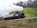
 Sampford Brett - 7828 (2857) up train.JPG 1,366 × 910; 690 KB
-
 Sampford Brett - D1010 climbing Castle Hill.JPG 1,366 × 820; 604 KB
-
 Sampford Brett - First 62192 (OIG1792).JPG 1,366 × 910; 564 KB
-
 Sampford Brett - First 69013 (SF55UAE).JPG 1,366 × 910; 520 KB
-
 Sampford Brett 1450.jpg 1,024 × 768; 570 KB
-
 Sampford Brett 73207 73119.jpg 1,024 × 512; 332 KB
-
 Sampford Brett 7828 and 6960.jpg 2,304 × 1,728; 1.93 MB
-
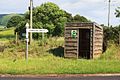 Sampford Brett bus shelter.JPG 1,366 × 910; 856 KB
-
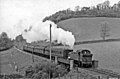 Sampford Brett geograph-2547022-by-Ben-Brooksbank.jpg 2,211 × 1,449; 533 KB
-
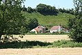 Sampford Brett, Mill Farm - geograph.org.uk - 1333558.jpg 640 × 427; 467 KB
-
 Sampford Brett, West Somerset Railway - geograph.org.uk - 46224.jpg 640 × 429; 125 KB
-
-
 Storage shed, Aller Farm - geograph.org.uk - 1654698.jpg 640 × 488; 94 KB
-
 The A358 - geograph.org.uk - 5027878.jpg 640 × 453; 83 KB
-
 The southern edge of Blackdown Wood - geograph.org.uk - 3336438.jpg 1,024 × 814; 300 KB
-
 Tower Hill, Williton - geograph.org.uk - 2148640.jpg 1,024 × 768; 250 KB
-
 West Somerset , Farm Buildings - geograph.org.uk - 6014884.jpg 6,000 × 4,000; 7.69 MB
-
 West Somerset , Honey Row Lane - geograph.org.uk - 6014883.jpg 6,000 × 4,000; 7.54 MB
-
 West Somerset Railway at Castle Hill - geograph.org.uk - 2747243.jpg 4,000 × 3,000; 2.85 MB
-
 West Somerset Railway at Castle Hill - geograph.org.uk - 2747250.jpg 4,000 × 3,000; 3.44 MB
-
 West Somerset Railway at Castle Hill - geograph.org.uk - 2747257.jpg 4,000 × 3,000; 2.96 MB
-
 West Somerset Railway at Castle Hill - geograph.org.uk - 4863229.jpg 4,000 × 2,400; 1.96 MB
-
 West Somerset Railway at Castle Hill - geograph.org.uk - 4869592.jpg 3,512 × 2,634; 2.2 MB
-
 West Somerset Railway near Williton - geograph.org.uk - 4869554.jpg 3,400 × 2,550; 2.33 MB
-
 Wooden boardwalk, Aller Lane - geograph.org.uk - 1654951.jpg 640 × 430; 179 KB
-
 Woolston Grange. - geograph.org.uk - 879388.jpg 640 × 428; 71 KB


_-_geograph.org.uk_-_4470026.jpg)
_-_geograph.org.uk_-_4470030.jpg)
_-_geograph.org.uk_-_4470031.jpg)
_-_geograph.org.uk_-_4470035.jpg)
_-_geograph.org.uk_-_4470046.jpg)
_-_geograph.org.uk_-_4470047.jpg)


_up_train.JPG)

.JPG)
.JPG)


